Arnis - Generate cities from real life in Minecraft
January 8, 2025
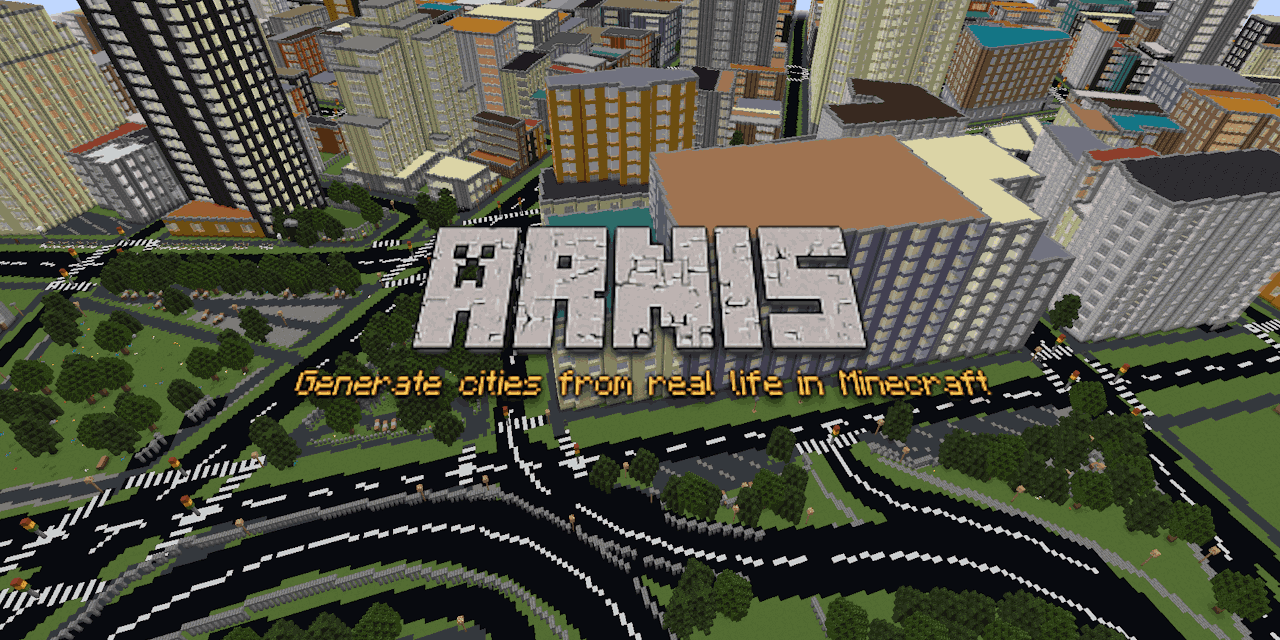
In the world of Minecraft, the ability to create vast, intricate worlds is one of its defining features. What if you could take this a step further by generating real-world locations with high levels of detail? Arnis makes this a reality by seamlessly integrating real-world geographic data into Minecraft. This open-source project, written in Rust, provides a solution to generate realistic, large-scale environments based on real-world geography and architecture.
What is Arnis?
Arnis is a tool that allows players to generate real-world locations within Minecraft Java Edition. By leveraging geospatial data from OpenStreetMap (OSM), Arnis transforms the data into Minecraft's blocky world. Whether you're replicating a favorite city or exploring a particular area, Arnis generates an immersive, detailed Minecraft world based on actual locations.
How Does Arnis Work?
The key feature of Arnis is its ability to process geographic data to generate Minecraft worlds. Here's how it works:
- Fetching Data: Arnis retrieves geospatial data for a selected area from the Overpass API, an open-source tool that extracts data from OpenStreetMap.
- Processing Raw Data: The tool parses the raw data into a Minecraft-readable format. Geographic elements like buildings, roads, and natural formations are identified and converted into Minecraft coordinates.
- Generating the World: The tool generates the Minecraft world based on the parsed data. Elements like buildings, highways, and land use are placed accurately within the world.
- Saving the World: Once the world is generated, players can explore it as if it were the real world.
Key Features of Arnis
- Real-World Geography: Uses OpenStreetMap data to replicate cities, landmarks, and natural features.
- High Detail: Generates complex structures and terrain with a high level of accuracy.
- Built with Rust: The project is built in Rust, ensuring faster performance and higher efficiency.
- Cross-Platform Support: Arnis runs on Windows, macOS, and Linux.
- Minecraft Support: Best results are achieved with Minecraft version 1.21.4, though older versions are also supported.
Why Use Arnis?
Arnis is perfect for Minecraft players looking to explore or recreate their favorite real-world locations with high detail. Whether you're working on a personal project, creating a city, or just exploring geography, Arnis makes it easy to replicate real-world locations.
The project is open-source, meaning it's free to use, and contributions are encouraged. The Rust implementation enhances performance, making it possible to generate even large-scale cities quickly and accurately.
Getting Started with Arnis
- Installation: Download the latest release or compile the project yourself.
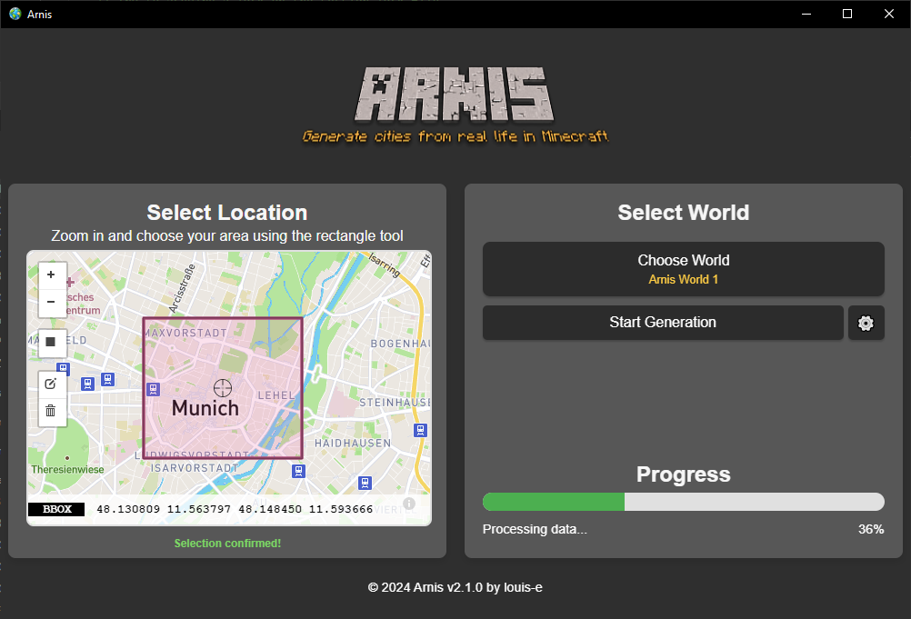
- Choosing a Location: Use the rectangle tool to select the area you want to generate. The world is generated starting at the Minecraft coordinates (0, 0, 0).
- Customization: You can use your own Minecraft world or generate a new flat world.
- Running the Tool: Click Start Generation, and watch as Arnis creates the world based on the selected area.

Known Issues and To-Do List
- Minecraft Versions: Currently, Minecraft versions 1.16.5 and below are not supported.
- Coastal Cities: Generating coastal cities may take a longer time.
- Ongoing Improvements: The tool is being updated with features like street names, older Minecraft version support, and more.
Conclusion
Arnis is an innovative tool that brings real-world geography into the blocky universe of Minecraft. Whether you're a passionate builder or a geography enthusiast, Arnis makes it easy to create real cities, natural features, and landmarks. Thanks to its open-source nature, Arnis continues to improve and grow, making it an excellent tool for creating unique worlds within Minecraft.
Video Tutorial
Watch this video tutorial to learn how to use Arnis:
Download Arnis
You can download the latest version of Arnis from the following sources:
Make sure to download the version compatible with your Minecraft installation. The latest release supports Minecraft 1.21.4 and above.
FAQs
-
How accurate are the real-world locations generated by Arnis? Arnis pulls its data from OpenStreetMap, which provides accurate geographic data for cities, roads, and buildings. However, the quality of data may vary by region.
-
Can I generate my own city or area in Minecraft? Yes, you can select any area from the real world using the rectangle tool and generate it in Minecraft.
-
What are the system requirements for running Arnis? Arnis is compatible with Windows, macOS, and Linux. Ensure you have Minecraft Java Edition (version 1.21.4 or later) installed for best results.
-
Can I contribute to the Arnis project? Yes! Arnis is open-source, and contributions are welcome. You can help by fixing bugs, improving features, or enhancing documentation.
-
Is there a graphical user interface (GUI) for Arnis? Yes, Arnis has a GUI that simplifies the process of selecting locations and generating the world. It's user-friendly and easy to navigate.